Venue familiarisation, records, remote access and project briefings
MOVE TO EXPLORE THE FIELD ↗
 REALITY:RATIOPlan a scan →
REAL SPACES · DIGITAL ENVIRONMENTS
Capture reality.
Work inside it.
We capture real environments and transform them into precise, immersive spaces where teams can explore, measure, collaborate and develop what comes next.
01 / CAPTURE
Start with the
real environment.
There is no single capture method for every space. We define what the environment needs to communicate, how accurately it must be recorded and what the team needs to do with it afterwards.
DRAG TO LOOK AROUND ↔
CAPTURE METHOD / 01Immersive context
ACTIVE METHOD360° capture
Navigable 360° environments and visual site records
Visual reference - not a measured survey
One captured environment can become
Point clouds2D CADBIM / RevitEngineering modelsGaussian environmentsInteractive workspaces
We will recommend the capture approach - or combination of approaches - that best fits the environment and intended outcome.
Discuss a capture project →02 / VIEWAVENUE
A REALITY:RATIO PRODUCTMore than a scan.
A place to work.
ViewAvenue transforms captured environments into secure, browser-based spatial workspaces where teams can explore, understand and develop projects together.
It brings the real space, project information, proposed assets and early concepts into one shared visual reference.
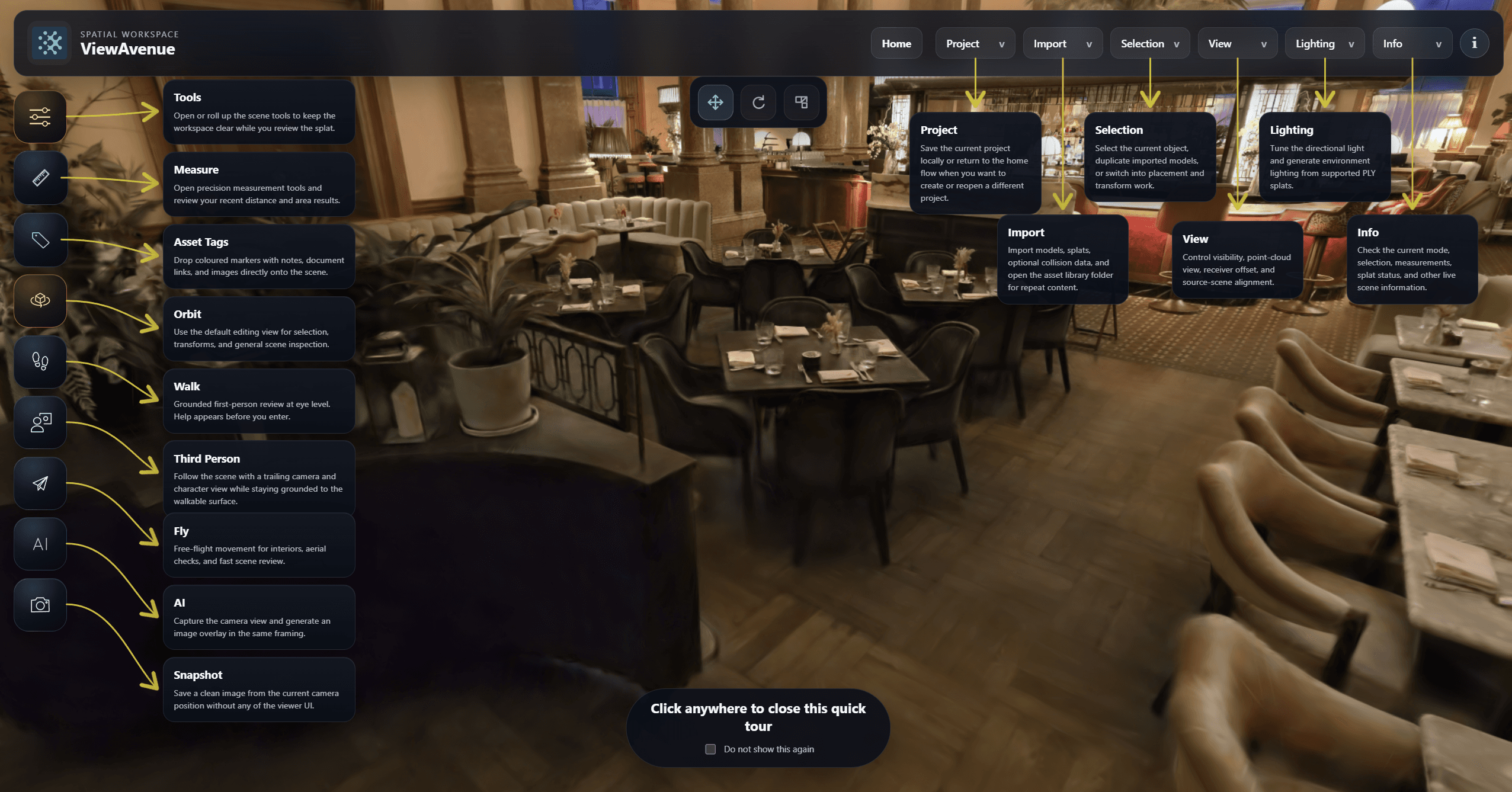
Return to the space without returning to site.
Give clients, designers and delivery teams access to the same visual environment from wherever they are working.
Test decisions against the real environment.
Measure, annotate and place proposed assets in context before committing detailed time and resources.
Keep everyone looking at the same thing.
Control project access by organisation and role, then share an explorable viewer when wider review is needed.
AI-ASSISTED CONCEPTS
From reality
to possibility.
Choose a real camera position, describe the intended atmosphere and use structured controls to develop an early visual concept grounded in the captured space.
AI concepts support early exploration and communication. They do not replace technically accurate design, specification or validation.
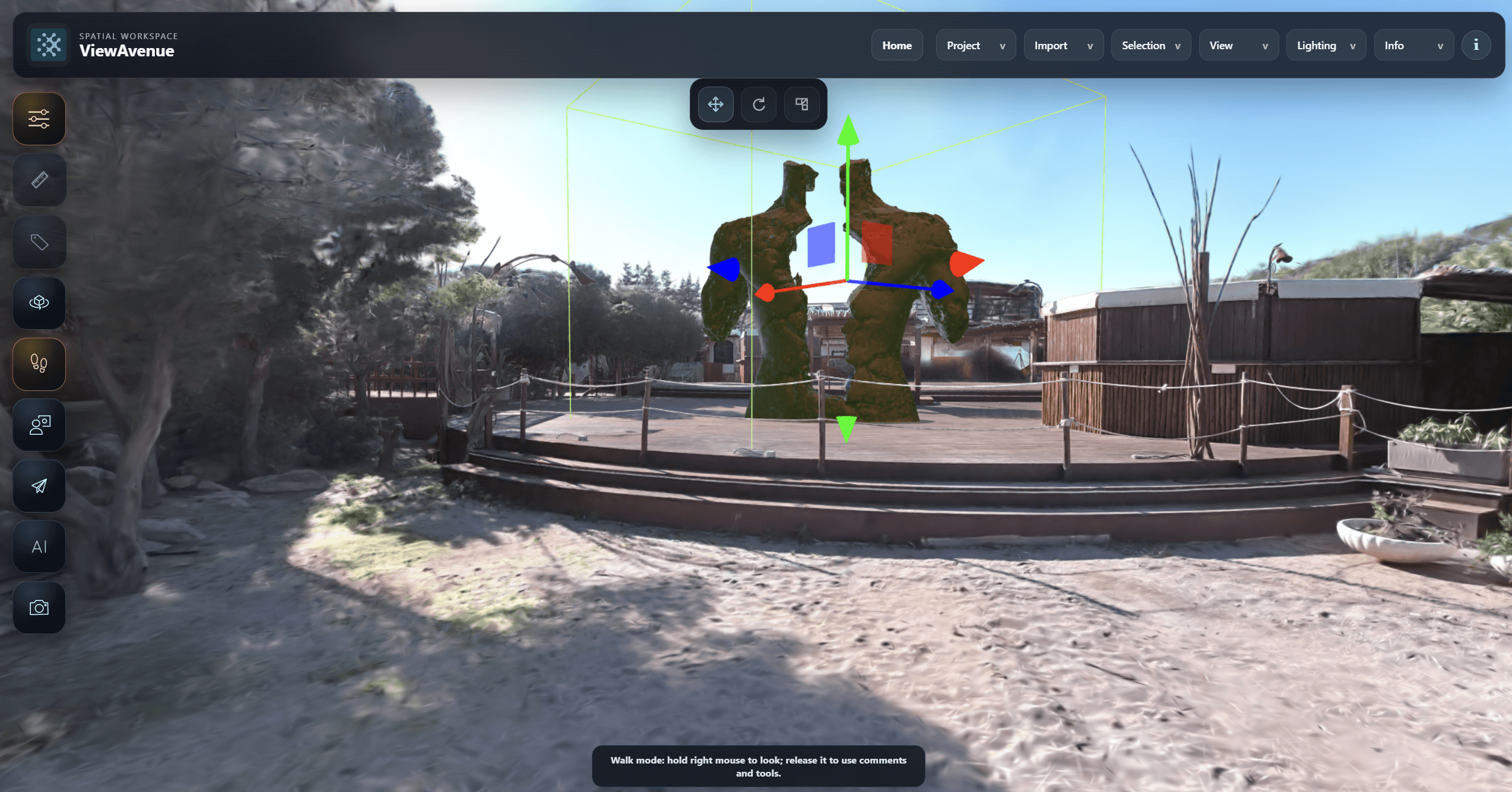
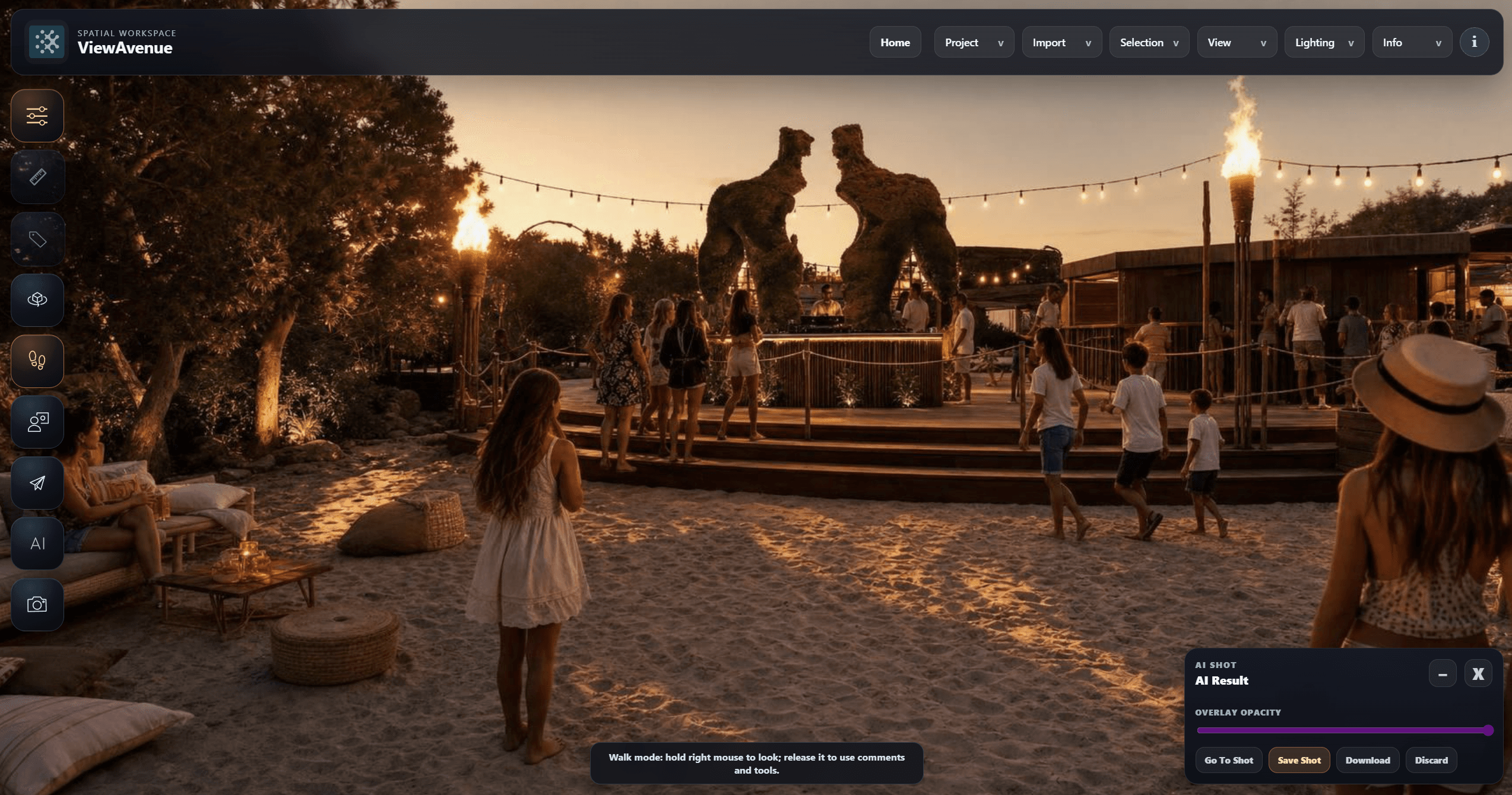
↔
EXAMPLE BRIEF /
“Transform this venue into a premium evening event with atmospheric lighting, considered furniture layouts and a strong focal experience, while retaining the existing architecture and camera position.”
SELECT VIEW→BUILD PROMPT→GENERATE→COMPARE
EXPLORE THE WORKFLOW
Open the supporting chapter most relevant to you.
DESIGN IN THE REAL SPACE
From captured venue
to developed idea.
ViewAvenue allows the team to move beyond passive viewing. Proposed 3D assets can be introduced, positioned and reviewed inside the real environment before an idea is developed further.
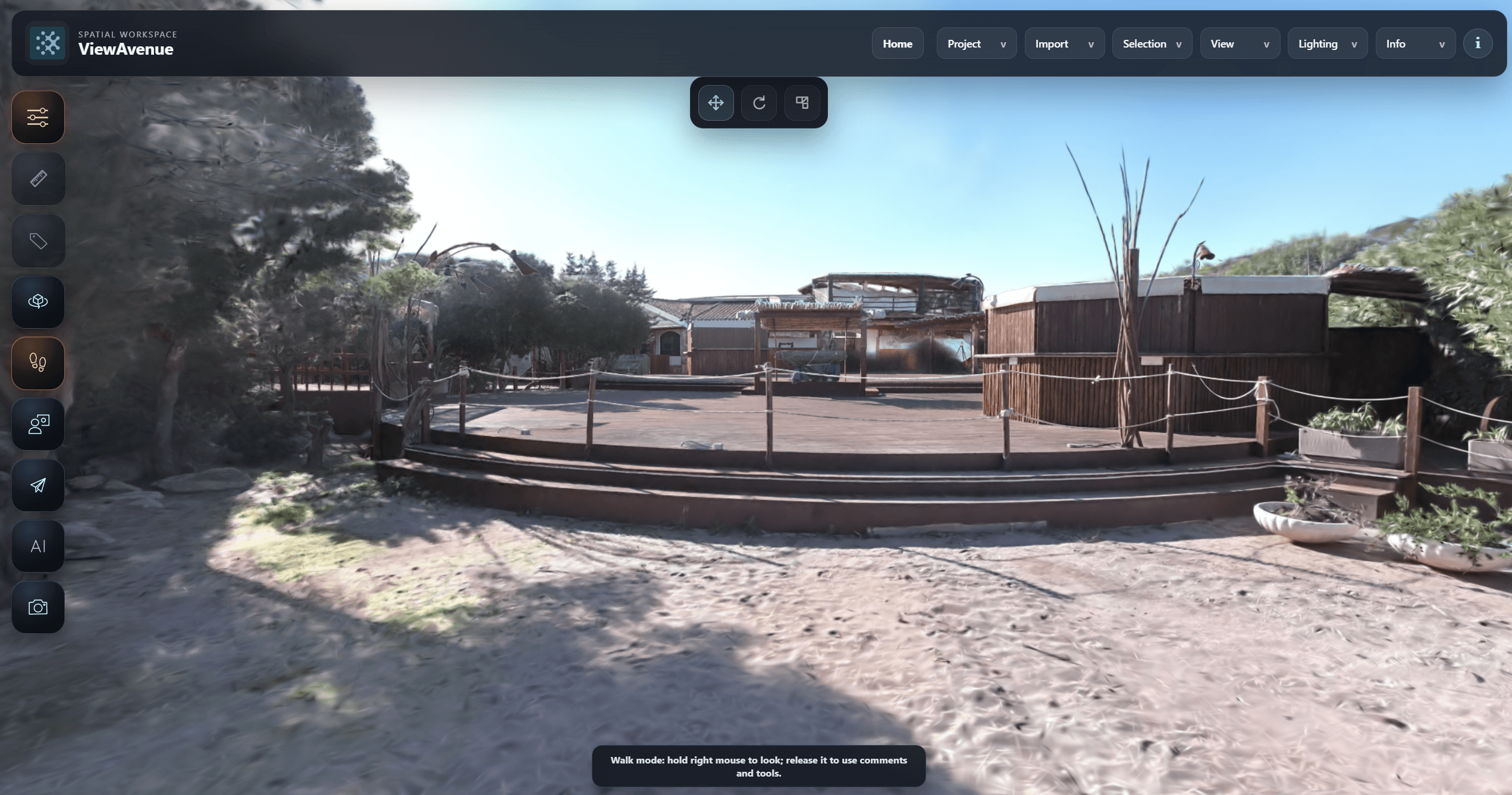
Begin with reality
The real environment remains the shared spatial reference.
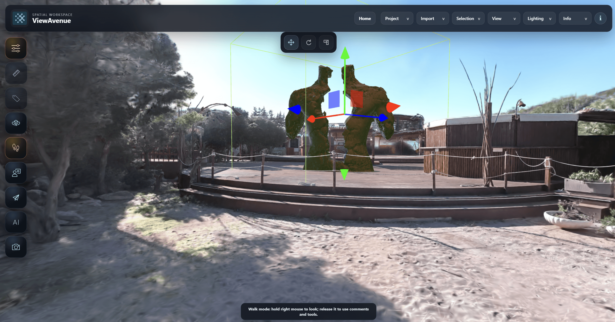
Test in context
Import a GLB asset and adjust its position, rotation and scale.
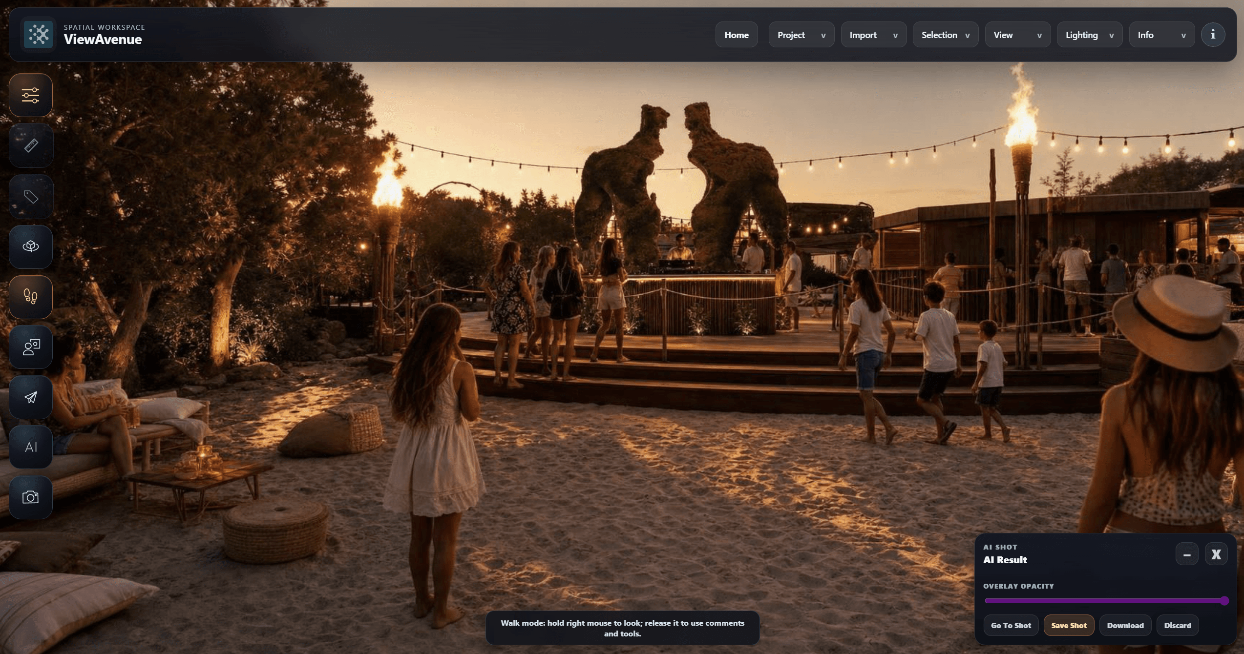
Understand the outcome
Review the idea where it will actually exist and build the next conversation around it.
THE PRINCIPLE
The captured environment remains the common reference. Measurements, project information, assets and concepts are understood in relation to the real place - not scattered across disconnected files and conversations.
ViewAvenue is currently in active beta development. Features are introduced and refined through real project use and structured partner feedback.
03 / APPLICATIONS
Built around the way
real teams work.
Different sectors use spatial information differently. The capture method, project environment and deliverables should follow the decisions the team actually needs to make.
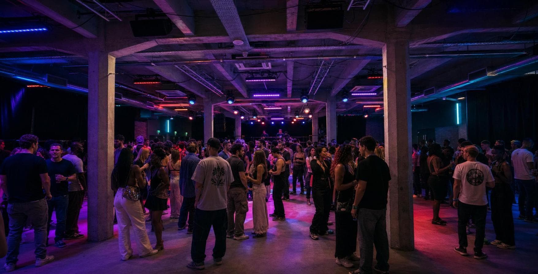
HOW THE WORKFLOW SUPPORTS IT
- 01Capture the venue and key operational areas
- 02Give the team a shared explorable environment
- 03Measure and test proposed assets in context
- 04Develop and compare early visual concepts
- 05Share the project for review and alignment
POSSIBLE OUTPUTS / USES
- Venue familiarisation
- Spatial design reviews
- Event asset placement
- AI-assisted concept views
- Client and supplier walkthroughs
CONNECTED PROJECT TEAM
Venues · agencies · production · AV · designers · clients
We define the intended use before selecting the capture approach.
Specialist spatial information becomes understandable to the wider project team.
Decisions stay connected to the real environment and the people involved.
The same capture can support visual, technical and collaborative workflows.
Not sure which workflow applies? Start with the space, the decision and the people who need to be involved.
Tell us about the project →04 / HOW IT WORKS
From site to shared
spatial workspace.
The process starts with the decisions the project needs to support. From there, capture, outputs and access are shaped around the environment and the people who need to use it.
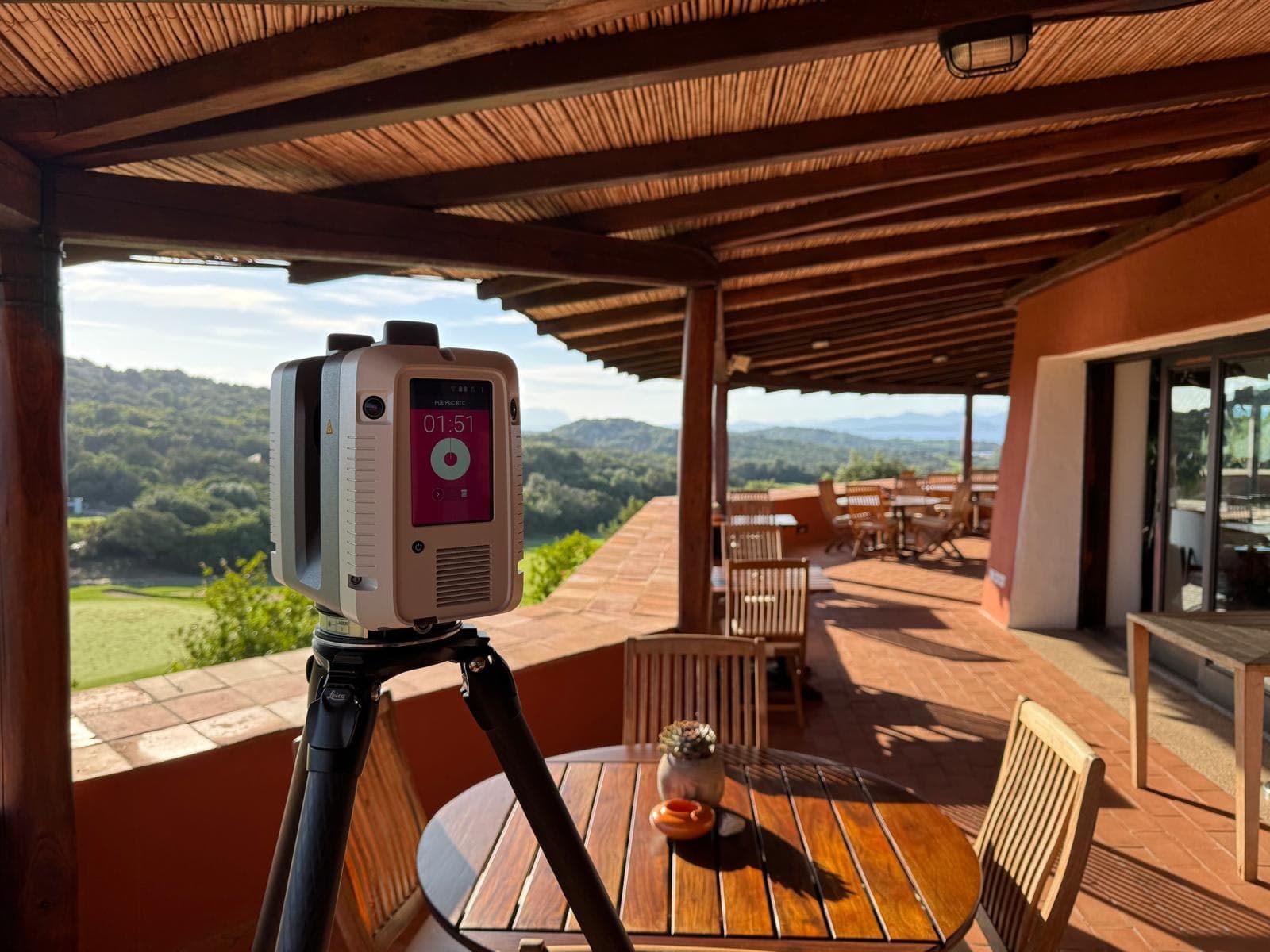
One purposeful record can support visual, measured and collaborative outcomes.
- 01Define & capture
We establish the purpose, required certainty and intended outputs before selecting the right combination of 360°, terrestrial laser or image-led Gaussian capture.
YOU RECEIVEA capture plan aligned to the project outcome.
- 02Process & prepare
The captured information is registered, checked and prepared for the agreed technical, visual and interactive uses.
YOU RECEIVEClean spatial data and agreed project outputs.
- 03Publish & organise
The environment is securely published in ViewAvenue, then allocated to the client organisation and the appropriate project team.
YOU RECEIVEA controlled workspace with role-based access.
- 04Explore & develop
The team can return to the environment to explore, measure, tag information, place 3D assets, develop AI concepts and share controlled views.
YOU RECEIVEA reusable spatial workspace - not a one-off file.
CAPTURE ONCE / USE IT DIFFERENTLY
Plan the right workflow →One environment can support several parallel outcomes: technical survey information, immersive access, design development and shared review.
05 / SELECTED PROJECTS
Real environments.
Useful outcomes.
The value of spatial capture is best understood through what it allows a team to do next. Our project stories connect the original environment, the chosen workflow and the decisions it supports.
FEATURED CASE STUDY / 01
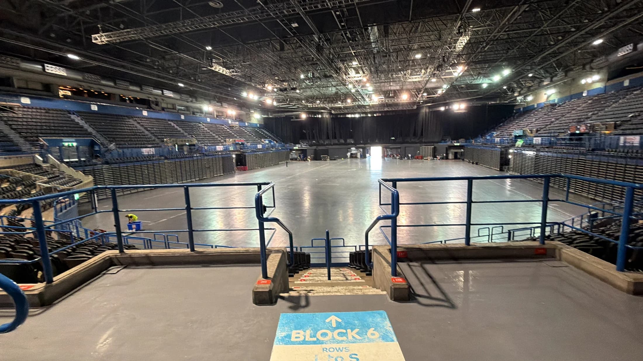
Utilita Arena
Birmingham
The real building.
A better basis for its drawings.
The arena’s existing architectural drawings were out of date and no longer accurately reflected what was on site. For NEC Group, the objective was a highly detailed capture to support the creation of updated drawings.
Reality:Ratio combined RTC360 terrestrial laser scanning, 360° photography and XGRIDS Gaussian capture. The laser scan data was used to produce ground-floor and concourse plans alongside two building sections.
- CLIENT
- NEC Group
- BRIEF
- Record existing conditions for updated drawings
- OUTPUTS
- Two floor plans, two sections and visual capture
ON SITE / THREE WAYS OF RECORDING REALITY
Measured detail. Visual understanding.
Each method has a different role. The laser survey provides the measured foundation; the visual captures help people understand the place behind the data.
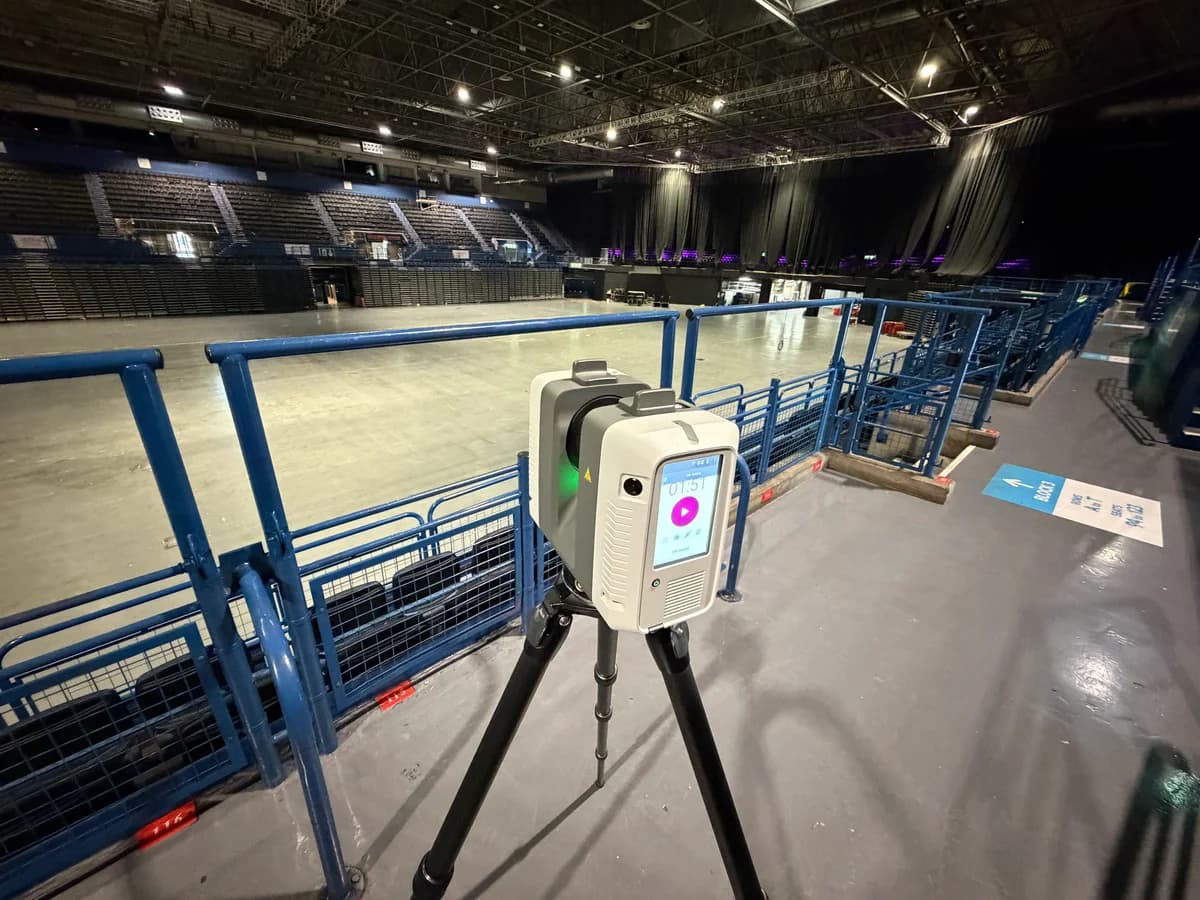
The measured foundation
Detailed spatial capture of the arena’s existing geometry, forming the survey reference for drawing production.
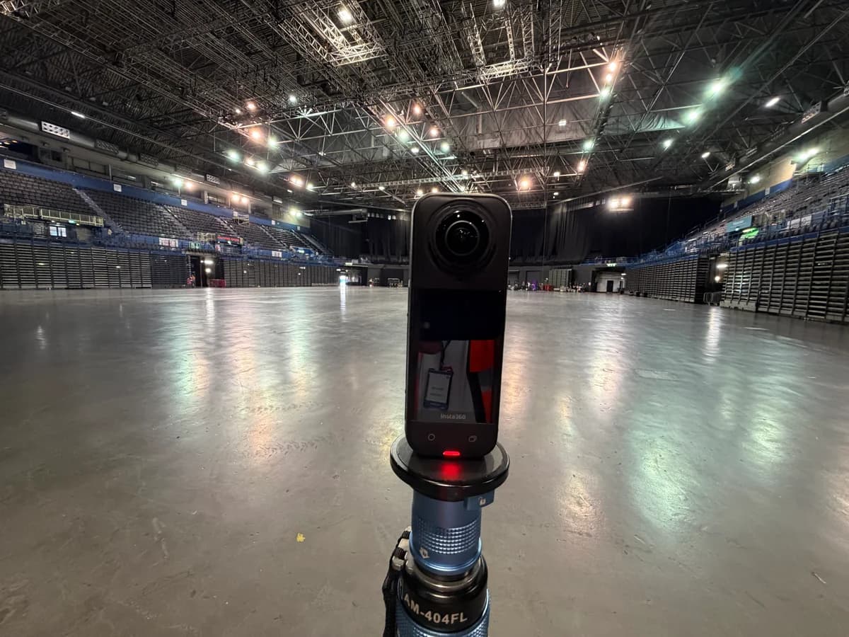
The surrounding context
A photographic record to revisit the space and interpret the details around the measured survey.
A space to return to
A photographic 3D environment, available as a project in ViewAvenue, complements the technical survey with an explorable view of the arena.
ON-SITE FOOTAGE / 16 SECONDS / NO AUDIOSCAN TO PLAN / ACTUAL PROJECT OUTPUTS
From captured geometry
to readable drawings.
Two floor plans and two sections translate the RTC360 survey into a familiar drawing format for stakeholder review and coordination.
Display previews only, not to scale. Not for construction or fabrication. Dimensions require on-site verification; unsurveyed and inaccessible areas remain outside the recorded scope.
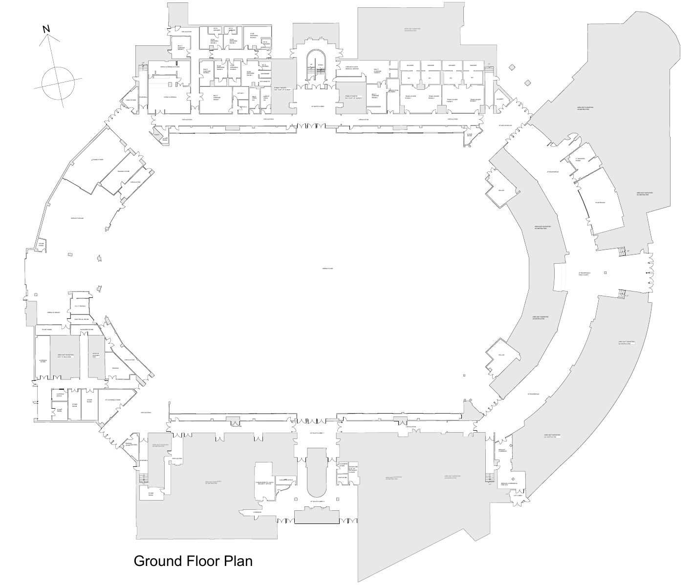
The arena floor and surrounding accommodation, with the surveyed scope and inaccessible areas identified.
FROM THE PROJECT / INTERACTIVE LASER SCAN
Look inside the survey.
Explore a sample of the arena’s laser scan. Orbit the point cloud, compare colour and intensity, or look around the scanner’s panoramic image.
UTILITA ARENA / TLS SAMPLE
Loads on request · approximately 8 MB
No account required
THE PURPOSE
Start with what is actually there.
The brief was not simply to create an impressive 3D view. It was to establish a detailed record of the real arena as the basis for updated drawings, with visual capture that makes that record easier to understand.
Discuss your site →CASE STUDIES IN DEVELOPMENT
Building an evidence-led project library.
As projects and permissions allow, this section will grow to include measured-survey outputs, existing-condition models, operational property records and client-approved ViewAvenue workflows.
Capture → registered point cloud → CAD / BIM deliverables
Capture → remote access → tags and spatial information
Real environment → placed assets → collaborative review
06 / ABOUT REALITY:RATIO
SPATIAL CAPTURE · VISUAL COMMUNICATION · SOFTWAREWe believe the most useful digital environments begin with an honest understanding of the real one.
Reality:Ratio exists to close the gap between capturing a space and being able to use it.
Spatial surveys can produce extraordinary information, but much of it remains difficult for the wider project team to access, interpret or apply to everyday decisions.
We combine capture services with visual communication and software development so the real environment becomes a practical foundation for technical work, creative exploration and shared understanding.
Record the environment with purpose.
We select and deliver 360°, terrestrial laser and image-led Gaussian capture around the project’s actual requirements - not around a preferred piece of technology.
- Site capture and planning
- Registered spatial information
- Visual and technical outputs
- Ongoing project context
Make the captured space usable.
ViewAvenue is being developed alongside real projects and beta partners to turn captured environments into accessible, controlled workspaces.
- Browser-based exploration
- Measurement and spatial information
- 3D assets and concept development
- Team access and controlled sharing
HOW WE APPROACH THE WORK
Technology should make the space easier to understand - not make the project more complicated.
Outcome before technology
The intended decisions and deliverables determine the capture method.
Reality remains the reference
Design ideas and project information stay connected to the environment they describe.
Specialist data made accessible
Technical spatial information should also be understandable to non-specialists.
Built through real use
ViewAvenue is refined through live workflows, structured feedback and practical project needs.
OUR POSITION
We are not trying to replace surveyors, designers, visualisers or project specialists. Reality:Ratio provides a more useful spatial foundation so those people can understand the environment earlier, communicate more clearly and focus their expertise where it adds the most value.
FOUNDERS / TEAM
The people behind Reality:Ratio.
Two different professional perspectives brought together by one shared objective: make spatial technology more useful to the people making real project decisions.

STEVEN DUFFY / FOUNDER & TECHNICAL LEAD
Exploring what the technology can make possible.
Steven brings more than 25 years of experience across digital environments and visualisation. He leads the technical direction of Reality:Ratio across capture, processing and interactive spatial workflows, with a focus on making powerful technology accessible and genuinely useful.
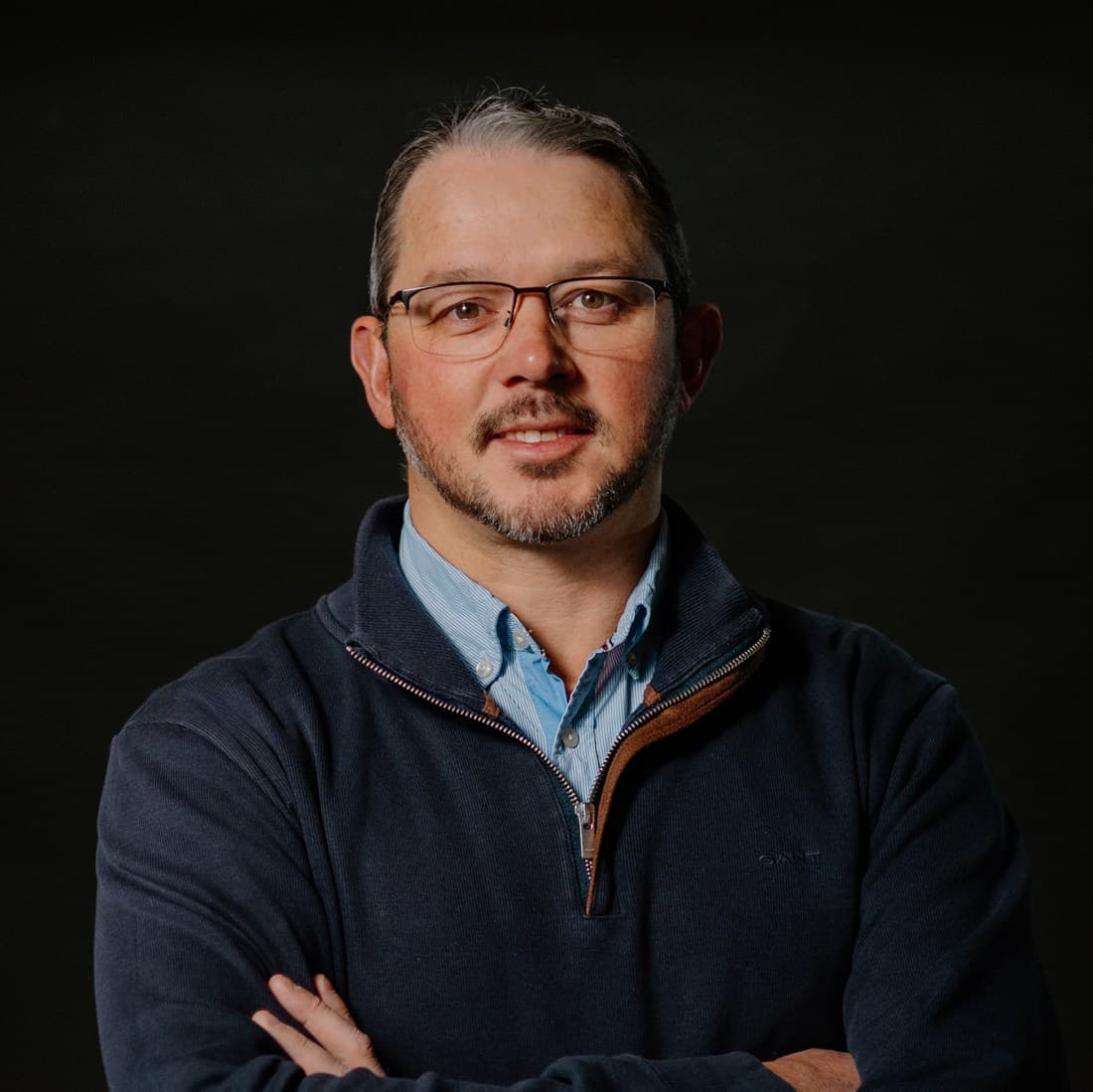
FRASER BURNETT / PROJECTS, PRODUCT & CLIENT DELIVERY
Turning capability into practical project value.
Fraser brings more than 20 years of experience across construction, operations, project delivery and reality capture. He works across surveying, client relationships, product development and commercial direction, translating real project needs into practical workflows.
DIFFERENT PERSPECTIVES / ONE GOAL
Steven asks what the technology can make possible. Fraser asks how it can solve a real-world problem. Together, they are building Reality:Ratio around the point where technical capability meets practical use.
07 / PLAN A SCAN
Start with the space.
We’ll plan the capture.
Tell us what you need to record, where it is and what the finished work should help your team do. We’ll recommend the right approach after reviewing your brief.
Plan a scan →Review preview: no request is sent yet.- 01What
Describe the space and the output you need.
- 02Where
Locate the site and add useful visual context.
- 03When
Choose a preferred date for the work.
- 04Why
Tell us what the capture will help you achieve.
START A CONVERSATION
What space are you
working with?
Tell us about the environment, the people who need to use it and the decisions the capture needs to support.
info@realityratio.xyz ↗